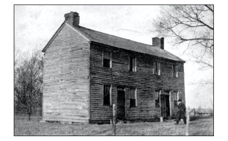
Haydon Tavern, erected in Whitley Point about 1834.
Courtesy of Mr. and Mrs. Marvin Voyles.
William G. Haydon bought the property on which the tavern was located from John Whitley, the first settler at Whitley Point. Haydon reportedly built the log structure that served as tavern and inn in 1834. That same year he began serving as Justice of the Peace. In addition to the tavern, Haydon maintained – perhaps in the same building — a store, post-office and school.
The tavern building was reportedly torn down by the then-owner, John Vogel, about 1918. Vogel, who had lived in the tavern building, then built a new house a few yards to the south.
The Whitley Point settlement was located in Section 12, of Whitley Township, in what became the southeastern part of Moultrie County.
Section 12 appears on the old atlas and plat maps, as follows:
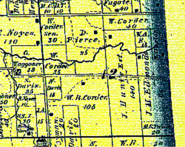
1875 Atlas – Section 12 – “J.H. Hunt Est.”
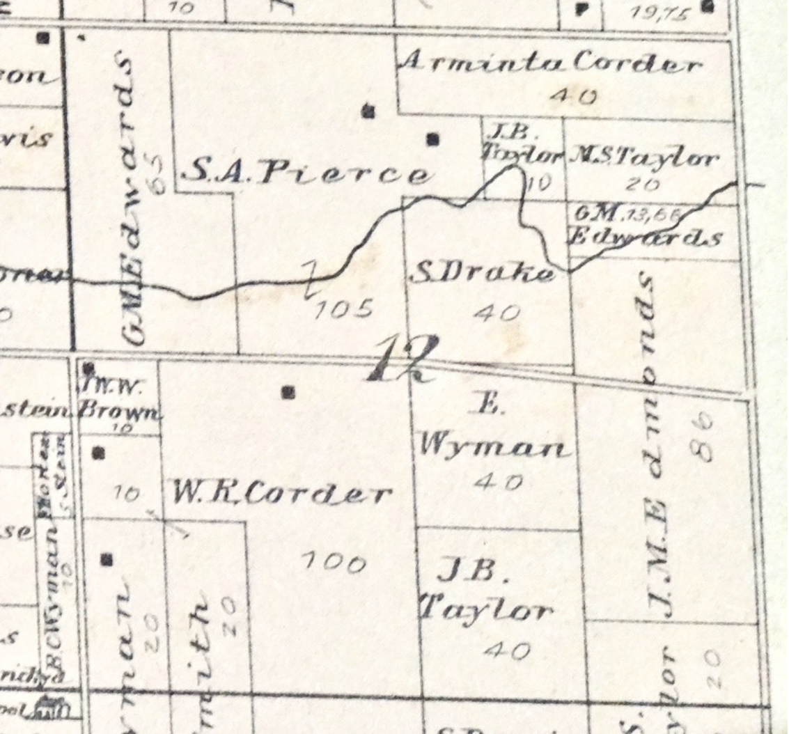
1895 Atlas – Section 12. S. Drake
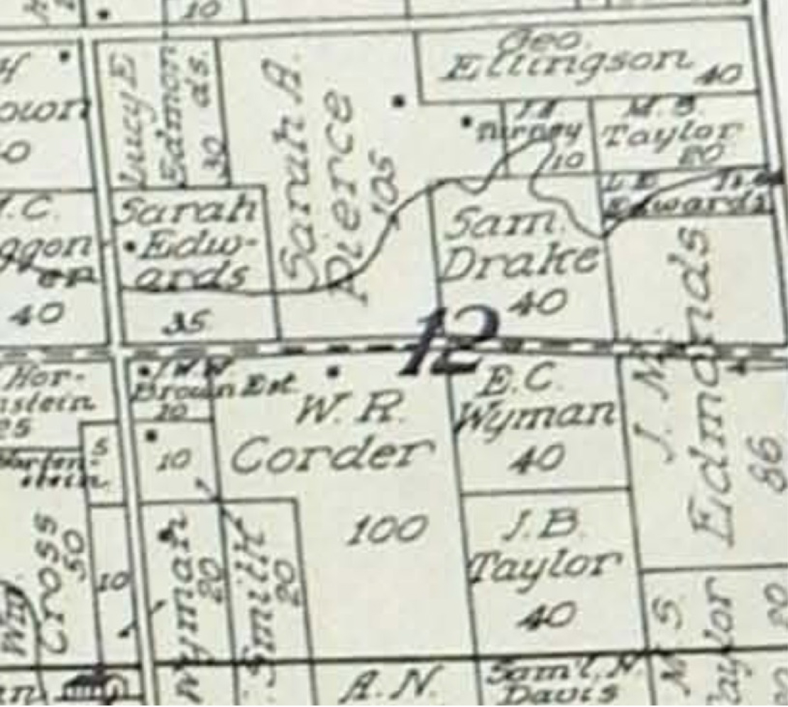
1913 Atlas – Section 12. Sam Drake.
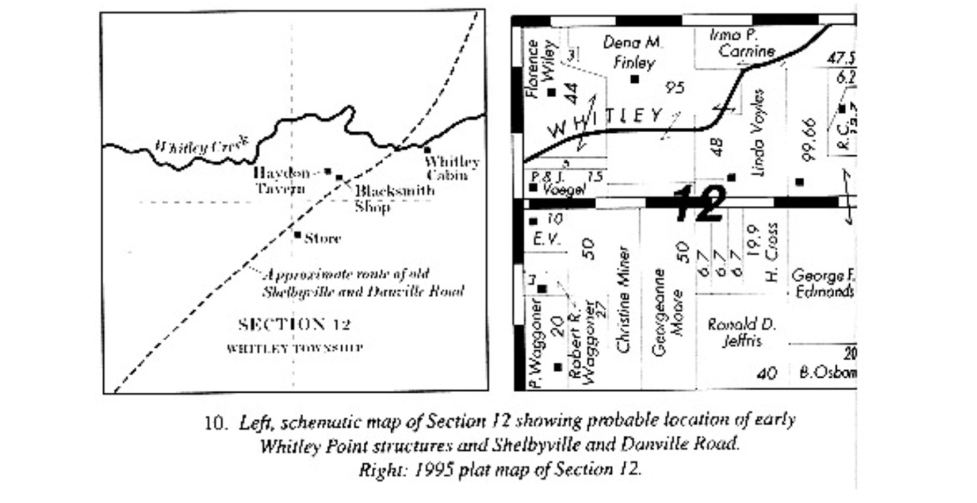
Note: the owner was identified in the 1995 map as Linda Voyles — see upper right quadrant.
Here is a recent aerial shot of the property, with likely locations of Whitley Point buildings marked in yellow.
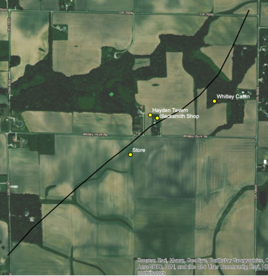
Current Satellite picture – Section 12.
(Yellow identification dots superimposed.)
The yellow dots superimposed on the current satellite picture above identify the Whitley Cabin, Haydon Tavern, and Blacksmith shop. These dots mark on the map where we think these structures were, based on information summarized in the Whitley Point Record Book,at p. 17. This current map does not itself confirm those locations.
However, another aerial shot – recently identified by Patrick Green, the GIS Manager and Field Coordinator at Public Service Archaeology and Architecture Research Program at the University of Illinois – seems to provide that confirmation. Mr. Green refers to this photo as a Hillshade” image (greyscale 3D representation of the earth’s surface). It is a model based on LiDAR data, or “Illinois Height Modernization (ILHMP).” This Hillshade photo comes from the Illinois Geospatial Data Clearinghouse.
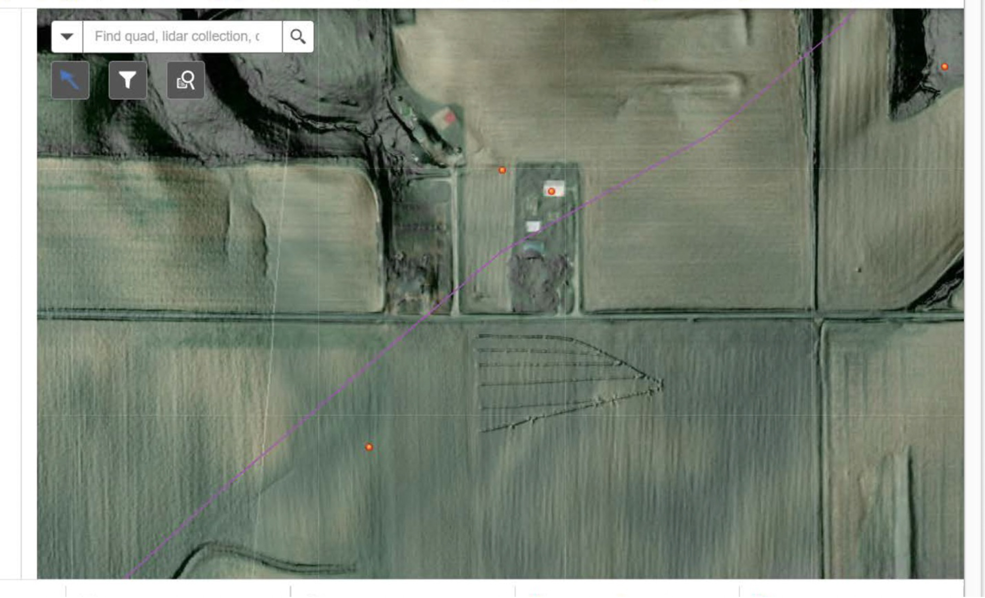
In this Hillshade photo the rectangular image in the upper left quadrant appears to outline the foundation site of a structure which may have been the tavern (magnified below) (orange dots added by U-I researcher):
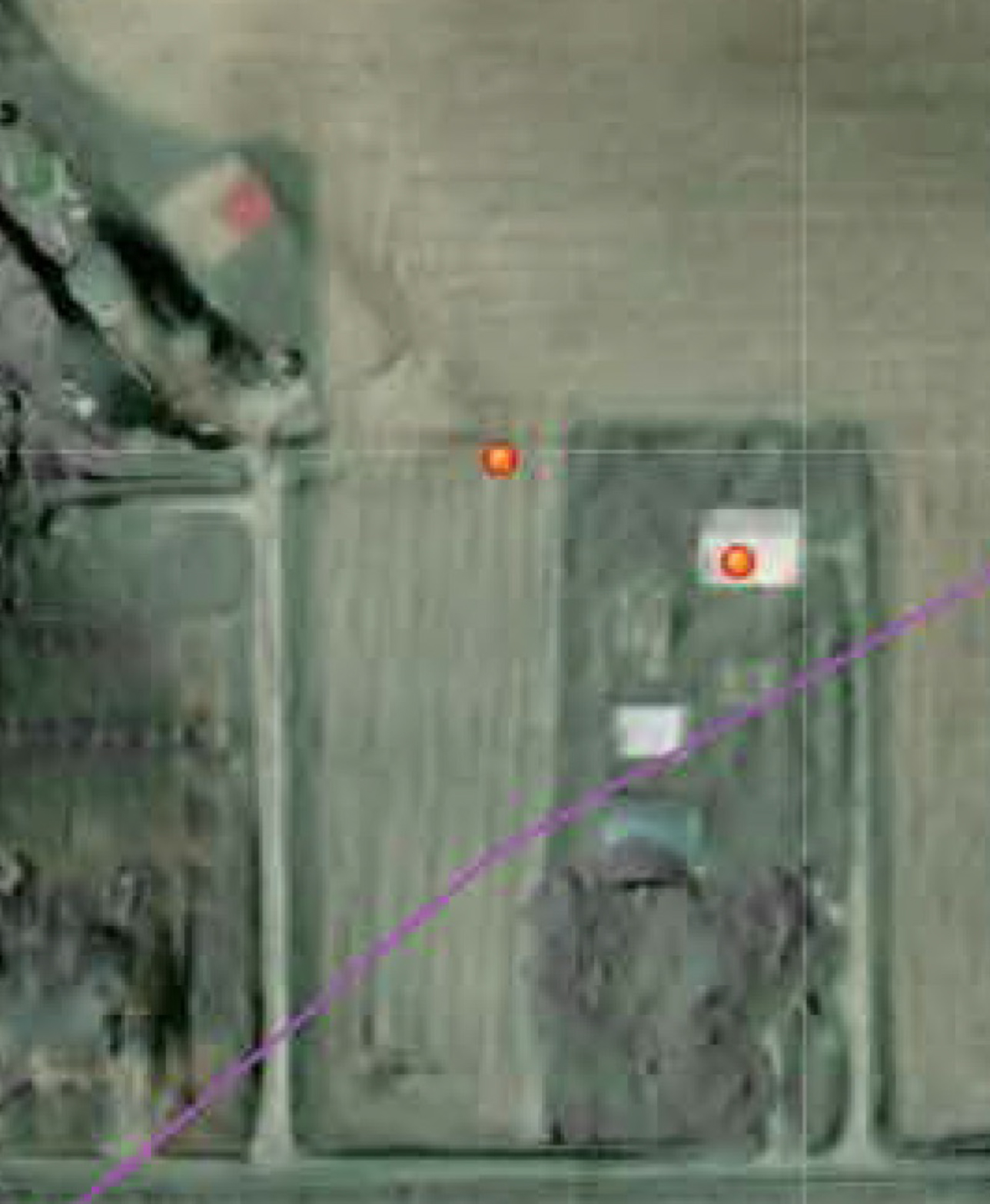
A north-south road leads to or from that rectangle.
A square immediately to the southeast of the rectangle may mark the old blacksmith shop. Further to the southeast, inside the vertical green rectangle, other slightly-shaded rectangles and a square may mark the remains of other vanished Whitley Point buildings.
The Vogel/Voyles farmhouse, which was reportedly built using wood from the demolished tavern structure, appears a few yards southeast of the possible location of the tavern.
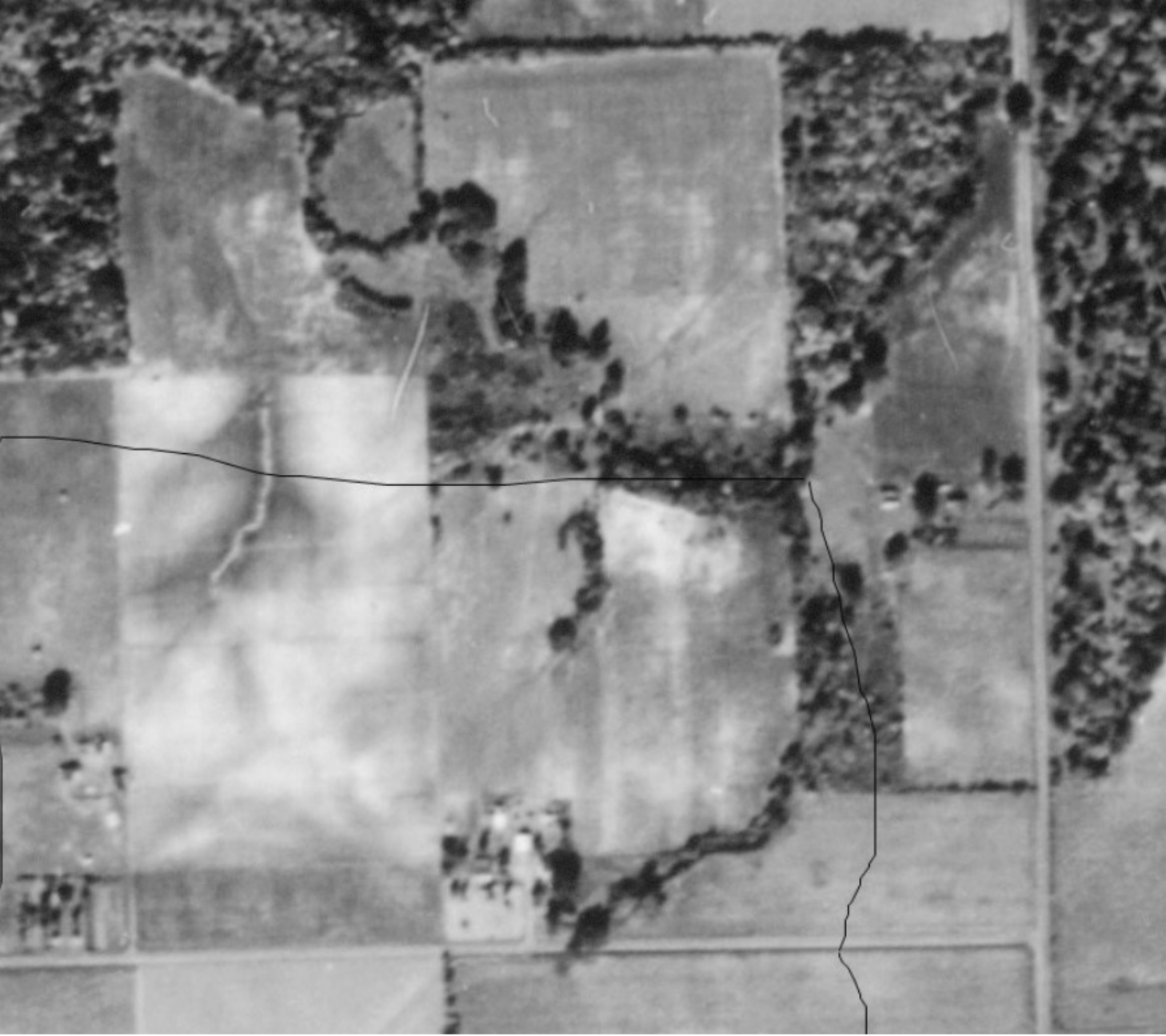
Another aerial picture which may be relevant is an older one taken in 1940 – only 22 years after the old tavern building was demolished. It shows Section 12, with the Voyles property being the lower right quadrant of the square section. It takes a trained eye to interpret shadowy shapes on the surface; but to my untrained eye, in the center of the upper left quadrant there is a rectangular shape on an angle – oriented northwest-to-southeast – just where it appears in the Hillshade photo above. The faint trace of a roadway appears to the west and south of that rectangular structure. Immediately to the east of this shape, there is a curving row of trees and, possibly, a pathway. A few yards further to the east, beyond the line of trees, in the upper right quadrant, there appears a faint rectangular shape in the field, as well as what might be the trace of a nearby ancient roadway, oriented northeast-to-southwest.
As Patrick Green, the U-I researcher observed to me in an email, “The best way to definitively tell if there are remnants of the old Whitley Point buildings is to find artifacts of that era within/nearby the locations of the plotted points” – such as pottery, hand blown glass, handmade nails and items like glass or coins bearing printed dates.